What if the USA was Rearranged based on Budget Gaps?
Barry Ritholtz recently had an intriguing article he linked to that showed a world map that was depicted as the world's countries rearranged by population. Since I have moved from being strictly an equity trader to a Muni bond trader I have taken more interest in the budget gaps and deficits that U.S. states and cities have. From the research I have done outside of work I originally decided 3 maps would be appropriate of the United States re-arranged based on their budget gaps. In the end only two were feasible to be shown here and the other will live within the hard drive of the computer that is bringing you this post.
So what if the map of the United States were rearranged based on Budget Gaps? The result would be a semi-disconcerting map.
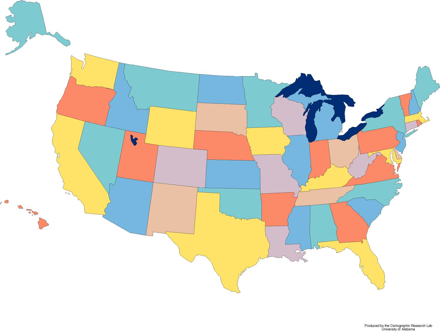
The first map is based off of total population. So the State with the highest budget gap aligned with the state with the largest population and so forth. So California with the biggest gap and largest population stayed the same and Texas with the second largest population became New York with their 21 billion dollar gap. The U.S. Capitol makes the biggest trek moving it's residents to Hawaii and the snow birds from New Jersey happen to stay in Florida year round. Click on the map below to see a bigger version.

Some interesting things I realized with this map Pennsylvania stayed in the same place as well as California. Ohio and Massachusetts swapped places with each other. Oregon moved right on up to Washington State, Utah moved just a tad further west to Nevada, Kansas moved one spot to the left, Nebraska moved just north, and Maryland and Wisconsin swapped places.
*Certain states had the same listed gaps such as Alabama, Colorado, and Oklahoma with 1.6 so in these cases for simplicities sake I went in alphabetical order for the correlated state because the data I used did not have exact figures. Both Montana and North Dakota have 0 dollars in budget gaps and therefore I marked them green and everything else black (in hindsight I should have made the other states red and these two black) (see excel sheet for some of the sample data)
The second map is based off of Budget gaps to total area. So California fell into Alaska and New York became Texas. The most interesting thing about this map is that both Vermont and Maine didn't move out of New England in fact they didn't move at all.
Would love to hear your thoughts and feedback on this self serving project I did for fun over the weekend in which my friend said your doing this for fun??

A special thanks to The Big Think: http://bigthink.com/ideas/25109 for the inspiration and idea to re-arrange America. If you have any questions or comments I more than welcome them.
References:
Data Used
U.S. Blank Map
Budget Deficits